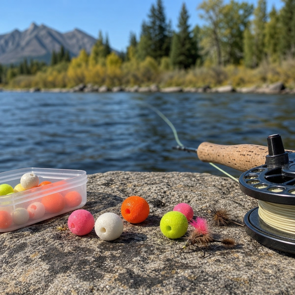
Fly fishing apps have become standard gear for anglers who want better water data, cleaner trip planning, and faster decisions on the river. A fly fishing app is any mobile tool that helps with maps, stream conditions, hatch timing, weather, knot references, fish logging, or community reports. The best fly fishing apps for your phone do not replace judgment or local knowledge, but they do reduce guesswork. After testing mapping platforms on tailwaters, using flow alerts before drift trips, and checking hatch logs in poor cell coverage, I have seen where mobile tools genuinely improve outcomes and where they create distractions. This matters because a bad app wastes time, drains battery, and feeds you stale information; a good one helps you find access, respect regulations, and fish more efficiently. For readers exploring technology reviews within product reviews and recommendations, this hub explains the major app categories, the leading options, and the tradeoffs that should shape your choice.
What Makes a Fly Fishing App Worth Downloading
The first question most anglers ask is simple: what should a fly fishing app actually do? The answer depends on how you fish, but strong apps usually solve four practical problems. First, they improve navigation with reliable maps, public and private land overlays, launch points, parking areas, and offline access. Second, they provide current conditions, especially river flow, water temperature, weather, and radar. Third, they support tactical decisions through hatch charts, moon phases, solunar predictions, knot guides, and species-specific logs. Fourth, they help with organization by storing catches, photos, waypoints, notes, and trip histories.
Good design matters as much as features. On the water, nobody wants to tap through cluttered menus with wet hands. The strongest apps surface key information quickly, cache maps for dead zones, and present readable layers without overwhelming the screen. Accuracy also matters. Streamflow should pull from recognized sources such as USGS gauges or state agencies. Weather should come from reputable meteorological providers. Maps should clearly distinguish legal access from private boundaries. If an app cannot do those basics, premium features do not save it.
Price is another filter. Many anglers start with free tiers, but subscriptions now dominate mapping and advanced condition tracking. Paying can be worth it when a single app consolidates access maps, gauge data, and offline navigation. It is less compelling when an app only republishes public data with a nicer interface. In my own use, the most valuable paid apps are the ones I trust before a trip, during a float, and again when logging patterns afterward. That continuity is what turns a download into part of your fishing system.
Best Fly Fishing Mapping Apps
If you fish unfamiliar water, mapping is usually the category that delivers the biggest immediate benefit. onX Fish is one of the most purpose-built options for anglers in the United States. Its strength is map context: public access, boat ramps, river miles, access easements, and private land boundaries. That combination matters on crowded rivers where crossing the wrong fence line can create legal trouble. Offline maps are useful in mountain valleys and canyon stretches where signal drops out. In practice, onX Fish works best for trip planning and access management rather than deep biological insight.
onX Hunt and onX Backcountry also deserve mention because many anglers already subscribe to them. While not built specifically for fly fishing, they offer excellent land ownership data, trail information, and downloadable maps. If your fishing overlaps with backpacking or hunting season scouting, one of these broader subscriptions may cover more ground. Gaia GPS is another strong alternative. It is especially effective for anglers who hike into remote creeks and want topographic layers, route creation, and backcountry navigation. Gaia is less fishing-specific, but its map stack is powerful.
Google Maps and Apple Maps still play a role for roads, shuttle planning, and locating nearby fly shops, campgrounds, and access pullouts. However, they should not be your primary source for legal access on rivers. They are transportation tools, not angling maps. For pure fishability, the best mapping app is the one that clearly answers three questions before you leave the truck: where can I legally enter, how far can I move, and can I navigate back without service.
Best Apps for River Conditions, Weather, and Flows
Conditions apps are the difference between showing up prepared and driving home after finding blown-out water. River App has become popular because it combines gauge readings, flow trends, and forecasts in a cleaner mobile experience than many raw agency sites. For anglers who want fast checks on discharge and stage, it is efficient. TroutRoutes also includes conditions tools alongside maps, making it appealing for wade anglers in trout regions. In several states, it offers stream access detail and regulation context that can shorten pre-trip research.
For weather, I recommend pairing a fishing-specific app with a dedicated meteorological tool. MyRadar is excellent for radar movement and storm timing. Windy offers high-value wind visualization, model comparisons, and broader atmospheric context. That matters on stillwaters and big western rivers where wind control determines whether nymphing, rowing, or casting is practical. The Weather Channel app is mainstream, but its hourly view is useful for planning temperature swings and precipitation windows.
Serious anglers should also bookmark direct sources. USGS National Water Dashboard remains a benchmark for streamflow and gauge data in the United States. NOAA is indispensable for forecasts, rain outlooks, and hazardous weather alerts. State fish and wildlife agencies often publish temporary closures, hoot owl restrictions, stocking notices, and local regulations before third-party apps update. In my own workflow, I use one convenience app for quick scanning and then verify critical decisions against USGS or state sources. That extra step prevents a lot of bad assumptions.
Best Hatch, Logbook, and Fish Tracking Apps
Not every fly fishing app needs to tell you where to park. Some of the most useful tools improve pattern recognition over time. Fishing Points is a broad fishing app, but many fly anglers use it for trip logs, location records, weather history, and bite prediction features. Its value is less about mystical forecasting and more about consistent journaling. If you record flow, temperature, fly choice, cloud cover, and time of day, you eventually build your own database of what works. That is far more useful than generic “best time to fish” claims.
ANGLR is another notable platform because it leans into catch logging and analytics. Competitive anglers and data-oriented users often like its structured approach. It can help with trip recall, especially when reviewing seasonal windows across multiple rivers. However, logging only helps if the process is frictionless. If entering catches feels like office work, you will stop using it. The best fish tracking app is the one you can update in under a minute while releasing a fish quickly and safely.
For hatch information, there is no perfect national app because insect timing is highly local. Regional trout apps, fly shop reports, and conservation group updates often outperform broad databases. I still use hatch charts as starting points, not hard promises. On many rivers, weather shifts can move emergence timing enough to make static charts misleading. A useful app explains expected insect windows, then lets you compare them with current temperatures, recent conditions, and user notes.
How the Top Fly Fishing Apps Compare
| App | Best For | Key Strength | Main Limitation |
|---|---|---|---|
| onX Fish | Access and river navigation | Private/public land clarity and offline maps | Subscription cost and limited international depth |
| TroutRoutes | Wade anglers targeting trout water | Stream access, regulations, and local trout context | Regional coverage varies by state |
| River App | Flow monitoring | Clean gauge tracking and trends | Depends on external data availability |
| Gaia GPS | Backcountry walk-in trips | Strong topo layers and route planning | Not fishing-specific |
| Fishing Points | Trip logging | Catch records and environmental notes | Prediction tools can feel generic |
| Windy | Weather planning | Detailed wind and model visualization | Can be complex for casual users |
This comparison shows why there is rarely one perfect app. Mapping leaders do not always have the best flow presentation, and the strongest weather tools may know nothing about legal access. Most anglers end up with a small stack: one map app, one conditions app, and one logging or reference app. That is usually a better approach than expecting one platform to dominate every task.
Choosing the Right App for Your Fishing Style
The best fly fishing app for your phone depends on whether you are a wade angler, boater, backpacker, guide, or occasional traveler. Wade anglers benefit most from access overlays, river mile markers, parking details, and regulation summaries. For this group, TroutRoutes or onX Fish often delivers the clearest practical value. Float anglers need launch points, shuttle logistics, hazard awareness, changing flows, and weather timing. They often pair onX Fish or a broader navigation app with River App and MyRadar.
Backcountry anglers prioritize offline maps, battery efficiency, route recording, and topo detail. Gaia GPS is excellent here, especially when combined with downloaded layers before leaving service. Guides and frequent travelers often care about speed and consolidation. They need to brief clients, verify conditions, and adjust plans quickly. For them, subscription value is easier to justify because time savings translate directly into fishable hours and client confidence.
Beginners should resist the urge to install every app they see. Too many alerts and dashboards can create analysis paralysis. Start with one map app and one conditions app. Learn how to use them thoroughly. Then add a logbook if you actually review your notes. Advanced anglers can benefit from deeper stacks, but even experts should keep a simple home screen setup. A phone should support awareness, not hijack attention from reading current seams, insect activity, and fish behavior.
Limits, Privacy, and Offline Reliability
Every fishing app has blind spots. Coverage can be uneven by state or country. Private land data may lag ownership changes. Gauge forecasts can miss sudden runoff or dam releases. Crowd-sourced reports can be inaccurate, exaggerated, or intentionally vague. This is why no app should be treated as ground truth. Cross-checking matters, especially when regulations, safety, and access are involved.
Privacy deserves attention too. Many apps collect location data, trip history, search behavior, and uploaded photos. That information can improve recommendations, but it also creates a record of your movements and favorite waters. Review permissions carefully. If an app wants constant background tracking, ask whether the benefit justifies it. I generally disable unnecessary permissions and avoid sharing exact catch coordinates publicly, especially on fragile fisheries that cannot absorb sudden pressure.
Offline reliability is the most underrated test. Before any trip, download the maps, open them in airplane mode, and confirm that layers actually render. Do the same with saved routes or access points. Also bring redundancy: a paper map, a screenshot of regulations, and a power bank. Phones fail in rain, heat, and cold. The best technology review advice is simple: trust good apps, but never trust them alone.
Our Overall Recommendations for the Best Fly Fishing Apps
If you want the clearest all-around recommendation, start by matching the app to the job. For legal access and river navigation, onX Fish is one of the strongest dedicated choices. For trout-focused wade planning in covered regions, TroutRoutes is highly practical. For fast flow checks, River App is efficient and easy to use. For remote route finding, Gaia GPS remains excellent. For weather, Windy and MyRadar are more dependable than most fishing-branded forecast tools. For trip records, Fishing Points or ANGLR can help if you commit to consistent note-taking.
The central lesson from reviewing the best fly fishing apps for your phone is that useful fishing technology is specific, not magical. The right app helps you answer immediate questions about access, flows, weather, and patterns with less friction. It does not replace river sense, local shop reports, or careful reading of regulations. Build a small toolkit, verify important data at the source, and test offline performance before you need it. If you are building out your own product reviews and recommendations workflow, use this hub as the starting point for technology reviews, then compare individual apps by region, fishing style, and subscription value before you commit.
Frequently Asked Questions
What features should I look for in the best fly fishing apps for my phone?
The best fly fishing apps for your phone should solve real problems you face before and during a trip, not just add clutter to your screen. The most useful features usually start with reliable mapping. Look for apps that show public access points, river reaches, boat ramps, trails, property boundaries, and offline maps you can use when you lose cell service. For many anglers, this alone makes an app worth keeping because it helps avoid trespassing, missed access, and wasted time driving around unfamiliar water.
Beyond maps, streamflow and water-condition data are essential. A strong fly fishing app should make it easy to check river flow, gauge height, temperature when available, and recent trends rather than showing a single number without context. Flow alerts are especially helpful if you fish tailwaters, freestones after rain, or fisheries affected by dam releases. Hatch timing, weather forecasts, wind speed, moon phases, and knot references can also be valuable, but they matter most when the information is accurate and easy to read quickly.
Many anglers also benefit from trip logging and note-taking tools. A good app can help you track where you fished, what flies worked, water levels, weather, and fish activity over time. That kind of record becomes more useful each season because it helps you recognize patterns instead of relying on memory. Community reports can be useful too, but they should be treated carefully. The best apps present crowd-sourced information as one signal among many, not as a guarantee of current conditions. In short, prioritize apps that improve navigation, planning, and on-the-water decision-making without overwhelming you with features you will never use.
Can fly fishing apps really improve success on the water, or are they mostly convenience tools?
Fly fishing apps can absolutely improve success, but usually in indirect ways. They rarely “catch fish for you,” and they do not replace observation, casting skill, presentation, or local knowledge. What they do very well is reduce avoidable mistakes. If an app helps you arrive at the right access point, avoid dangerously high flows, identify a likely hatch window, or remember which side channel fished best at a certain discharge, that can dramatically improve your day before you ever make the first cast.
Apps are especially helpful for planning efficiency. Instead of guessing whether a river is fishable after runoff or whether a tailwater will be blown out by a release change, you can check current data in seconds. That means fewer wasted trips and better timing. On unfamiliar water, map layers and local regulations can also save you from fishing closed sections or stepping onto private land. Those are practical advantages that matter to both beginners and experienced anglers.
That said, the best anglers use apps as support tools, not as crutches. A hatch chart might suggest what should be happening, but the insects on the water matter more. A weather forecast might say light wind, but the canyon you are standing in may tell a different story. In real use, fly fishing apps are most powerful when they help you ask better questions and make faster adjustments. They increase confidence, sharpen preparation, and cut down on guesswork, which often translates into better fishing outcomes over time.
Are paid fly fishing apps worth it, or can free apps handle most anglers’ needs?
For some anglers, free apps are enough. If you mostly fish familiar water, need only a basic weather forecast, and occasionally check river flow from public sources, there is a good chance you can piece together a workable setup without paying. Many free tools provide useful stream gauges, simple maps, knot instructions, or general forecasts. If your fishing is casual and local, that may cover the essentials.
Paid fly fishing apps become more worthwhile when you need specialized features in one place. Premium mapping with property boundaries, high-quality offline access, custom waypoints, saved routes, and detailed access overlays can justify the cost quickly, especially if you travel often or explore new water. The same goes for apps that offer dependable flow alerts, integrated weather tools, hatch planning, logbooks, and better usability than a patchwork of separate free services. Convenience is part of the value, but so is speed and reliability when conditions change fast.
The real question is whether a paid app helps you fish better, safer, and more efficiently often enough to matter. If you routinely fish tailwaters, drift trips, remote streams, or unfamiliar public-private mixes, a subscription can be money well spent. If you fish the same home river every weekend and already know the access and seasonal patterns, the value may be lower. A smart approach is to identify the one or two features that matter most to your style of fishing and evaluate whether the paid version delivers a meaningful upgrade over free alternatives.
How accurate are fly fishing apps for stream conditions, hatches, and fishing reports?
Accuracy depends heavily on the type of information and where the app gets its data. Streamflow data tied to official gauges is often the most dependable because it comes from established monitoring sources. Even then, anglers should pay attention to update timing, gauge location, and whether the reading reflects the specific stretch they plan to fish. A river can change significantly between an upstream gauge and a downstream access point, and tailwater releases can shift conditions faster than many people expect.
Hatch information is useful, but it should be treated as a seasonal guide rather than a precise promise. Apps can tell you what commonly appears in a given region and roughly when, but insect activity is influenced by temperature, elevation, sunlight, cloud cover, water type, and short-term weather patterns. In practice, hatch charts are best used to narrow fly selections and set expectations before a trip. Once you are on the water, actual bugs, rises, and subsurface activity should drive your decisions.
Community fishing reports are the least consistent category. They can be valuable for broad patterns, like whether a river is crowded, off-color, or producing on nymphs versus dries, but they may be outdated, exaggerated, vague, or highly specific to one time of day. Good anglers read them with skepticism and compare them against flow data, weather, and recent conditions. The most reliable fly fishing apps present data clearly, update frequently, and make it obvious whether information comes from sensors, forecasts, historical averages, or user submissions. The better you understand that difference, the better you can judge what to trust.
What is the best way to use fly fishing apps without becoming too dependent on them?
The smartest approach is to use fly fishing apps to support judgment, not replace it. Start with pre-trip planning. Check streamflows, weather, access, regulations, and any relevant hatch information the night before and again before leaving. Save offline maps if you may lose service. Set alerts for water releases or major flow spikes if you are fishing a tailwater or runoff-sensitive river. This kind of preparation gives you a strong baseline and helps avoid obvious mistakes.
Once you are on the water, shift your attention back to the river itself. Watch current speed, clarity, insect life, fish behavior, wind, and angling pressure. If the app suggested one plan but the river shows something else, trust what you observe. The most effective anglers use digital tools for fast reference, then make real-time decisions based on conditions in front of them. Apps are excellent for confirming, comparing, and recording, but they should not distract you from reading water and adapting naturally.
It also helps to build a habit of logging your own results. Record flows, weather, flies used, productive water types, and timing. Over time, your personal notes become more valuable than generic advice because they are tied to your waters and your experience. That is where fly fishing apps can offer lasting value: not just in providing data, but in helping you build your own pattern library. Used this way, they become a practical extension of your fishing process rather than a substitute for skill and awareness.