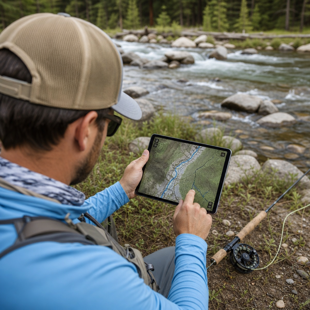
Fly fishing mapping software has become one of the most important tools in a modern angler’s kit because it turns scattered river knowledge into usable decisions about access, safety, species, seasonality, and presentation. In plain terms, fly fishing mapping software is any digital map platform, mobile app, or GPS-enabled system that helps anglers locate fishable water, identify public land and stream access, read contours, evaluate flows, and navigate on the water. The best fly fishing mapping software does more than drop pins. It layers hydrology, land ownership, satellite imagery, weather, waypoints, trails, and offline navigation into one interface so anglers can plan effectively before leaving home and adapt once boots hit the bank.
This category matters because good maps save time, reduce trespass risk, and improve catch odds. I have used these tools while scouting western tailwaters, bushwhacking to brook trout creeks in the Appalachians, and checking legal access around heavily parcelized trout rivers where one wrong crossing can create conflict. A strong mapping platform answers practical questions quickly: Is this reach public? Can I launch here? What is upstream gradient? How far is the walk? Will I have service? Which fork holds colder water in late July? Those answers affect not only convenience but also fish welfare and personal safety. On crowded, regulated rivers, mapping software can be the difference between a productive day and an expensive mistake.
As a hub article for technology reviews under product reviews and recommendations, this guide covers the leading software categories, the features that matter most, and where each platform fits. It also helps readers understand a key distinction: no single app is perfect for every angler. Some are strongest for property boundaries, others for route finding, and others for hydrological data. The best choice depends on whether you fish driftless spring creeks, big western freestones, alpine lakes, saltwater flats, or warmwater rivers from a kayak. By the end, you should know which mapping tools deserve a place in your system, how to compare them intelligently, and how to combine them for better on-water decisions.
What the Best Fly Fishing Mapping Software Must Do
The best fly fishing mapping software solves five jobs reliably. First, it identifies fishable water with enough detail to distinguish main channels, side channels, ponds, spring seeps, shoals, and access roads. Second, it clarifies ownership and legal access using parcel overlays, public land boundaries, easements, and stream access markers where available. Third, it supports navigation with downloadable offline maps, GPS tracking, waypoint storage, and route creation. Fourth, it adds environmental context such as USGS flow gauges, precipitation, snowpack, weather radar, and elevation profiles. Fifth, it remains usable in the field through an interface that is fast, battery-conscious, and readable in bright light.
When I evaluate mapping tools for fly fishing, I look beyond the marketing screenshots. Accuracy matters more than visual polish. A gorgeous satellite basemap is not enough if the app mislabels roads, omits gates, or fails to distinguish private inholdings inside national forest boundaries. Search matters too. A good app lets you search by river name, gauge, coordinates, county road, trailhead, or saved waypoint without friction. Sync reliability is another differentiator. If waypoints fail to download before a remote trip, the software has not done its job. The strongest platforms also let users mark hazards such as diversion dams, impassable deadfall, or shallow riffles that affect raft launches and walk-wade routes.
For fly anglers specifically, software needs differ from those of general hikers or hunters. Anglers care about channel shape, gradient transitions, cutbanks, confluences, braids, beaver ponds, access intervals, and parking pullouts. They also care about repeatability. Productive spots are often patterns rather than secrets: north-facing tributaries in heat, deep bends below bridge crossings during runoff, or meadow reaches with undercut banks in late evening. Good mapping software helps identify those repeatable characteristics across new watersheds, making it valuable not just as a navigation aid but as a fish-finding system.
Top Software Categories and Best Use Cases
Different mapping platforms dominate different jobs, so the smartest recommendation is usually a stack rather than a single subscription. OnX Hunt, despite its hunting-first branding, is one of the most useful tools for fly anglers because its land ownership data, public-private boundaries, and offline maps are consistently strong. TroutRoutes is purpose-built for trout anglers and stands out for river access information, trout regulations, and fishing-specific presentation. Google Earth remains excellent for desktop scouting because historical imagery reveals channel migration, side channels, beaver activity, and parking changes over time. Gaia GPS is a top choice for backcountry route planning and custom layer management. Navionics is relevant for stillwater anglers and some boat-based warmwater or coastal applications because it specializes in bathymetry.
BaseMap and HuntStand can also serve anglers who prioritize parcel data and broad public-land coverage, while Caltopo is superb for advanced planning, slope analysis, and custom printed maps. For streamflow and watershed intelligence, many experienced anglers supplement mapping apps with USGS Water Data, NOAA weather products, and state agency regulation maps. These are not always elegant, but they are authoritative. In practice, a western trout angler might scout structure in Google Earth, verify access in OnX, confirm flows through USGS gauges, and then save a route in Gaia GPS for offline use. That workflow is more effective than relying on a single app to do everything moderately well.
| Platform | Best For | Key Strength | Main Limitation |
|---|---|---|---|
| OnX Hunt | Access and land ownership | Parcel boundaries and offline reliability | Less fishing-specific context |
| TroutRoutes | Trout stream discovery | Access points, regulations, species focus | Regional coverage varies |
| Google Earth | Desktop scouting | Historical imagery and channel analysis | Limited legal access data |
| Gaia GPS | Backcountry planning | Layer control and route building | Steeper learning curve |
| Navionics | Lakes and boat fishing | Depth contours and marine navigation | Weak for river access research |
If you want one concise answer to the question, “What is the best fly fishing mapping software?” the most balanced response is this: OnX Hunt is the best all-around access and navigation tool, TroutRoutes is the best fishing-specific option for trout anglers, and Google Earth is the best free scouting tool. For remote walk-in trips, Gaia GPS often becomes the best companion app. The right decision depends on whether access certainty, fish-focused overlays, or terrain planning is your highest priority.
OnX Hunt: Best for Access, Boundaries, and Offline Reliability
OnX Hunt has earned its place in fly fishing because access is often the limiting factor, not fish abundance. In states with a patchwork of ranches, state parcels, BLM, county roads, and public easements, the app’s ownership layers reduce guesswork. I have used it extensively on rivers where a ten-minute walk can cross several ownership changes, and its parcel labels made the difference between a legal pullout and a problematic one. For anglers, the practical value is straightforward: you can identify legal approaches, mark parking, and avoid wandering across private corners that are poorly signed on the ground.
Its offline map function is one of the strongest in this category. Downloading large areas before a trip is simple, and GPS positioning remains dependable when there is no service. The app is also fast enough for on-water checks without burning too much time or battery. Another benefit is consistency. Whether you are checking a meadow creek in Montana, a warmwater river in Missouri, or a forest access road in Pennsylvania, the interface behaves predictably. That matters in bad weather or low light when you need instant answers.
Limitations exist. OnX is not built around hatch charts, trout regulations, or species annotations in the way dedicated fishing apps are. Water detail can be strong visually, but the fishing interpretation still comes from the user. For that reason, OnX is best viewed as a legal access and navigation platform first, and a fish-finding tool second.
TroutRoutes: Best for Trout Anglers Who Want Fishing Context
TroutRoutes was designed around the actual questions trout anglers ask. Which streams hold wild trout? Where are the public access points? What regulations govern this stretch? In supported regions, the app consolidates those answers better than general mapping software. It is especially useful for anglers exploring unfamiliar waters close to home, because it lowers the barrier to entry. Instead of opening multiple state agency PDFs and piecing together county maps, users can scan a basin and quickly identify trout water, stocking information where available, and practical entry points.
I find TroutRoutes most useful in the scouting phase and on exploratory half-day trips. If I have a few hours and want a realistic chance of finding legal water with public access, it can narrow the field fast. The software also helps newer anglers understand how stream sections are organized. That educational value is significant. Good apps should not just display information; they should improve decision-making. TroutRoutes does that by translating technical fishery and access data into a format ordinary anglers can apply.
The tradeoff is scope. Coverage depth varies by geography, and anglers who fish beyond trout-centric regions may need other tools. It also does not replace independent regulation checks before a trip, especially where seasonal closures, tackle restrictions, or private-right exceptions exist. Used correctly, however, it is one of the most relevant fly fishing technology reviews winners in this category.
Google Earth and Gaia GPS: Best for Scouting Water You Have Never Seen
Google Earth remains one of the most underappreciated fly fishing mapping tools because it teaches anglers how to read water at landscape scale. Historical imagery can reveal side channels that disappear seasonally, recent flood changes, gravel bar growth, or beaver complexes that create holding water. I regularly compare leaf-off and leaf-on imagery to identify hidden meadow bends, bridge pullouts, and places where a creek runs close to a public road before disappearing behind private timber. That kind of visual interpretation is difficult inside many app ecosystems.
For freestone rivers, satellite imagery helps identify riffle-pool cadence, canyon pinch points, and wider glides that may warm faster in spring. For stillwaters, it can expose weed lines, shoals, inlets, and launch areas. The weakness is obvious: imagery alone does not prove legal access or current conditions. A washed-out bridge, new gate, or changed easement may not be visible. That is why Google Earth is a scouting engine, not a final authority.
Gaia GPS complements Google Earth by handling route building, imported tracks, and advanced map layers with more precision. It is particularly strong for backcountry anglers hiking into alpine lakes, high-country creeks, or wilderness drainages where trail junctions, elevation gain, and water crossings matter as much as the fishing itself. Its layer library can include topographic maps, satellite imagery, public land overlays, and weather sources, creating a robust field package. The learning curve is steeper than simpler apps, but serious anglers who adventure beyond roadside water often find Gaia GPS worth the effort.
Features That Separate Great Mapping Software from Average Apps
The first separator is data quality. Land ownership must be credible, hydrography must be detailed, and trail or road layers must reflect reality. The second is offline performance. A map that only works with service is not serious backcountry software. The third is waypoint and organization capability. Productive anglers build systems: access points, fishable runs, alternate parking, hazards, camp spots, and emergency exits all need labels and folders. The fourth is battery efficiency. Bright screens, active GPS, and satellite layers can drain a phone before lunch, so efficient caching and low-friction controls matter.
Another differentiator is how well the software supports pattern recognition. Can you quickly compare tributaries by elevation and shade? Can you evaluate gradient by contour spacing? Can you identify floodplain width and likely undercut bank habitat? Advanced anglers do not only ask where fish are today; they ask why a watershed should fish well under certain temperatures, flows, and seasons. The best fly fishing mapping software helps answer both questions.
Finally, trustworthiness matters. No app should be treated as infallible. Property lines can lag updates. Access easements can change. Flow gauges can fail or sit far from the water you are actually fishing. The strongest users cross-check critical information, especially before floating, crossing private land, or fishing special-regulation reaches.
How to Choose the Right Software for Your Fishing Style
If you mostly fish roadside trout rivers and care about legal access, start with OnX Hunt and add TroutRoutes if your region is well covered. If you spend evenings scouting new water from a laptop, Google Earth is indispensable and costs nothing. If your trips involve long approaches, wilderness navigation, or custom routes, prioritize Gaia GPS. If you fish reservoirs, large lakes, or coastal water from a boat, add Navionics for depth contours and navigation safety.
Budget matters, but value matters more. One avoided trespass issue, one efficient backup plan during high flows, or one saved hour on a short trip can justify the right subscription. The strongest setup for many anglers is a two-tool system: one app for access and one for scouting or navigation depth. Keep your waypoints organized, download maps before every trip, and verify regulations from primary sources.
Best fly fishing mapping software is not about replacing watercraft. It sharpens it. The right platform helps you find legal water, understand terrain, adapt to conditions, and fish more confidently with less wasted time. As the hub for technology reviews in this subtopic, the clear takeaway is simple: choose software based on how you fish, not on brand popularity alone. Start with your biggest constraint, test one or two platforms thoroughly, and build a mapping system that makes every day on the water smarter.
Frequently Asked Questions
What is fly fishing mapping software, and why is it so useful?
Fly fishing mapping software is a digital tool that helps anglers understand water before they ever step into it. Depending on the platform, it may combine topographic maps, satellite imagery, stream and river layers, public land boundaries, access points, GPS navigation, saved waypoints, weather data, and sometimes flow or depth information. The reason it has become so valuable is simple: it turns scattered pieces of information into one usable system. Instead of checking multiple websites, paper maps, and local regulations separately, an angler can often review river access, identify likely holding water, confirm whether an area is publicly accessible, and plan a safe route from one place.
For fly anglers specifically, mapping software is useful because success is closely tied to reading water and making efficient decisions. Good maps can help you identify riffles, runs, pools, side channels, drop-offs, confluences, meanders, and elevation changes that often influence trout, bass, salmon, or steelhead positioning. It also helps with practical concerns that matter just as much as fishing skill, such as where you can legally park, how far you’ll need to hike, whether private property boundaries are nearby, and which stretches may be easier or safer to wade. In modern fly fishing, the best mapping software is not just a convenience feature. It is a planning, safety, navigation, and fish-location tool all at once.
What features should I look for in the best fly fishing mapping software?
The best fly fishing mapping software should do more than simply show a river on a screen. At a minimum, it should provide reliable map layers, easy GPS positioning, and enough detail to help you make decisions about access and fishable structure. High-quality topographic maps are important because they help you understand gradient, canyon sections, nearby roads, and trails. Satellite imagery is equally valuable because it can reveal river braids, gravel bars, side channels, vegetation lines, and potential entry points that may not be obvious on a standard map. Public and private land overlays are another major feature because they help reduce trespassing risks and clarify where access is likely to be lawful.
Beyond those basics, the most useful platforms often include waypoint marking, route planning, offline maps, stream names, boat launch information, and integration with weather or water data. Offline capability is especially important for fly anglers because many of the best fisheries are in remote areas with weak or nonexistent cell service. If a map cannot be downloaded in advance, it may become far less useful in the field. For anglers who target moving water, flow and gauge integration can be a major advantage because river level changes affect safety, wading conditions, insect activity, and fish location. Ease of use also matters. A feature-rich app that is difficult to navigate can be less effective than a simpler platform that lets you quickly assess access, structure, and position while standing riverside. The best option is usually the one that combines detailed layers, dependable field performance, and a user interface that helps you act on information quickly.
Can mapping software really help me find more fish, or does it mostly help with navigation?
It absolutely can help you find more fish, although not in a magic-button way. Mapping software does not replace local knowledge, observation, presentation, or time on the water, but it can dramatically improve where and how you spend your time. A major advantage is that it helps you eliminate unproductive water and focus on stretches with stronger potential. By studying contours, channel bends, access locations, and visible structure, you can identify places where fish are more likely to hold, feed, or move during different conditions. For example, a map may reveal deeper outside bends, braided sections that create soft seams, tailouts below riffles, feeder creeks that cool a river in summer, or slower wintering water in a larger system.
It also helps you think more strategically about seasonality and pressure. If one access point is highly visible and easy to reach, mapping software may help you identify a less pressured stretch upstream, a walk-in section with fewer anglers, or an alternate piece of public water nearby. In that sense, it supports better angling decisions, not just better navigation. When paired with weather, flow trends, and knowledge of local hatches or species behavior, mapping software becomes a fish-finding framework. It helps you ask the right questions before you arrive: Where will fish seek current relief? Where are likely feeding lanes? Where might water remain cold enough in midsummer? Where can I move safely and efficiently between target zones? So while navigation is one of its most obvious uses, its bigger advantage is often that it sharpens your ability to predict fishable, high-percentage water.
How important are offline maps and GPS features for fly fishing trips?
Offline maps and GPS are extremely important, and for many anglers they are non-negotiable features. Fly fishing often takes place in valleys, canyons, forests, mountain watersheds, and backcountry environments where mobile coverage is unreliable. A map that works perfectly at home but disappears on the river is not much help when you are trying to locate a trail, confirm an access point, or navigate back to your vehicle before dark. Offline map support allows you to download the area in advance so key layers remain available without service. That is essential for both convenience and safety.
GPS location adds another layer of usefulness because it shows exactly where you are in relation to river channels, property boundaries, trail systems, and saved waypoints. This matters when you are hiking to a remote tributary, floating a new section, or trying to relocate a productive run you found earlier in the day. GPS can also help prevent avoidable mistakes, such as crossing onto private land unintentionally or underestimating how far a put-in or take-out really is. In practical terms, anglers use offline maps and GPS to pin access points, mark productive holes, note insect activity, save campsites or parking spots, and record routes that worked well. When water levels rise, weather changes quickly, or daylight fades, that information can become more than convenient. It can be the difference between a smooth trip and a risky one.
Is fly fishing mapping software better than traditional maps and local knowledge?
The best way to think about fly fishing mapping software is not as a replacement for traditional maps or local knowledge, but as a powerful upgrade and complement to both. Paper maps still have value because they are durable, easy to view at a broad scale, and never run out of battery. Local knowledge remains invaluable because it captures what no map can fully show, such as recent access changes, seasonal fish movement, hatch timing, river etiquette, and subtle wading hazards. However, mapping software adds speed, flexibility, and precision that older methods simply cannot match on their own.
What makes digital mapping especially effective is its ability to combine different layers of decision-making into one system. You can compare access options, trace tributaries, zoom into likely holding water, check distances, save locations, and adapt your plan in real time. That said, software is only as good as the angler using it. It can help you find a promising bend, but it cannot tell you exactly how fish are reacting to water temperature that afternoon or whether a local hatch is peaking just before dark. The strongest anglers tend to use all three sources together: digital mapping for planning and navigation, paper backups for reliability, and local insight for context and nuance. In that combination, fly fishing mapping software becomes one of the most valuable tools in a modern angler’s kit because it helps translate information into better choices on the water.