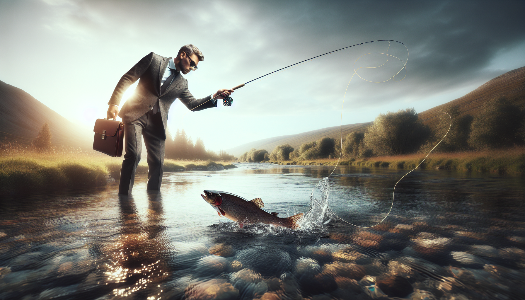
Technology has become one of the most important forces shaping modern fly fishing conservation, helping anglers, guides, biologists, and watershed groups protect the fish and rivers they depend on. In this context, fly fishing conservation means the science, practices, and policies used to sustain wild fish populations, restore habitat, reduce angling pressure, improve water quality, and promote ethical stewardship across entire watersheds. I have worked with conservation-minded outfitters and restoration nonprofits, and the pattern is consistent: the best outcomes happen when field experience is paired with precise tools, reliable data, and practical communication. For a sub-pillar hub focused on conservation efforts, technology matters because it turns good intentions into measurable action, whether that means monitoring stream temperature, mapping barriers to migration, tracking invasive species, or teaching anglers how to minimize handling stress. It also connects this topic to related areas such as catch-and-release ethics, habitat restoration, river access, public policy, and climate resilience, making it a foundational page for the broader conservation and ethics conversation.
How Monitoring Technology Improves Fishery Management
The first role of technology in fly fishing conservation is simple: it helps people see what is actually happening in a river system. Without monitoring, management decisions rely too heavily on assumptions, sporadic observations, or outdated surveys. With monitoring, agencies and nonprofits can identify stressors early, establish trends, and respond before a fishery declines sharply. Common tools include temperature loggers, dissolved oxygen meters, flow gauges, electrofishing survey equipment, PIT tagging systems, sonar counters, and remote cameras. In coldwater fisheries, temperature is often the most actionable metric because trout and salmon are highly sensitive to thermal stress. Many managers now use continuous temperature loggers to identify reaches that exceed safe summer thresholds, then implement hoot owl restrictions, habitat shading projects, or altered stocking and access decisions.
A well-known example comes from western trout streams where managers combine USGS streamflow data with in-river temperature sensors to predict afternoon stress periods. That information allows guide services to end trips before water temperatures become dangerous for released fish, and it gives state agencies defensible evidence for temporary closures. Similar methods are used in Atlantic salmon rivers, where counters and telemetry can show whether fish are reaching spawning grounds or being delayed by warm tributaries, dams, or low flows. Good monitoring also improves communication with anglers. Instead of vague warnings, organizations can publish current conditions and explain exactly why changing tactics, times, or locations protects fish. That direct, evidence-based guidance is one of the strongest conservation tools available.
GIS, Mapping, and Watershed Planning
Conservation efforts work best at watershed scale, not just at the level of a favorite run or a single access point. Geographic information systems, drone imagery, LiDAR, and satellite mapping allow practitioners to analyze rivers as connected ecological networks. In my experience reviewing restoration plans, mapping often reveals the real limiting factor faster than weeks of anecdotal debate. A stream may look healthy in one reach, yet GIS layers show upstream road crossings, irrigation withdrawals, sediment inputs, floodplain disconnection, or thermal exposure that suppress fish recruitment across the whole system. This is why modern fly fishing conservation depends on spatial data.
Mapping tools help answer practical questions: Where are culverts blocking migration? Which tributaries stay coldest in August? Which parcels offer the best opportunity for riparian restoration or public access easements? Which reaches produce juvenile fish, and which merely hold adults seasonally? Agencies, land trusts, and river groups increasingly combine parcel maps, habitat surveys, stream order, land cover, and water rights data to prioritize projects that deliver the greatest biological return. A barrier removal project, for example, can reconnect dozens of upstream miles and improve spawning success far more than a cosmetic in-channel improvement in an already accessible reach.
Drone surveys have also changed restoration design. High-resolution imagery can capture bank erosion, channel migration, woody debris placement, side-channel activation, and vegetation establishment with far less labor than repeated ground-only surveys. That does not replace fieldwork, but it makes fieldwork smarter. For a hub page on conservation efforts, this matters because many related actions—barrier removal, access planning, habitat repair, wildfire recovery, invasive species control—begin with accurate mapping.
Data-Driven Habitat Restoration and Project Prioritization
Habitat restoration has always been part science and part craft, but technology has sharply improved both design quality and accountability. Effective restoration is no longer just adding rocks or logs where a river looks simplified. Today, practitioners use geomorphic assessments, hydrologic models, sediment budgets, floodplain connectivity analysis, and post-project monitoring to determine what a river needs and whether a project works. In trout streams, the goal may be cooler water, deeper pools, spawning gravel retention, overhead cover, and access to high-flow refuge. In salmon systems, restoration may focus on reconnecting floodplains, reopening side channels, or removing passage barriers so fish can reach historic habitat.
The strongest programs prioritize projects using biological and physical metrics rather than convenience. They ask which action will improve survival, reproduction, or resilience most effectively per dollar spent. Some projects deliver quick visible change but limited population benefit; others look less dramatic yet transform a basin. Technology helps distinguish between the two. Below is a practical comparison of common conservation effort categories and the tools often used to guide them.
| Conservation effort | Technology used | Main benefit for fisheries | Real-world application |
|---|---|---|---|
| Thermal refuge protection | Temperature loggers, GIS, remote sensors | Reduces stress during heat events | Seasonal closures on vulnerable trout reaches |
| Barrier removal | Culvert inventories, drone imagery, hydraulic modeling | Restores migration and spawning access | Replacing perched road crossings with fish-passable structures |
| Riparian restoration | LiDAR, aerial imagery, vegetation monitoring apps | Improves shade, bank stability, insect production | Planting native willows along degraded meadow streams |
| Flow management | USGS gauges, diversion data, watershed models | Protects habitat quantity and water temperature | Negotiating timed releases below reservoirs |
| Invasive species response | eDNA, mapping platforms, mobile reporting tools | Detects threats early and targets removal | Monitoring whirling disease vectors or illegal fish introductions |
That project-based lens is essential for a conservation hub because readers often ask where to focus money, volunteer time, or advocacy. The answer is not one-size-fits-all. Technology helps local groups identify the specific intervention most likely to produce lasting ecological gains.
Angler Apps, Digital Education, and Ethical Behavior Change
Conservation is not only about agencies and scientists. Everyday angler behavior shapes fish survival, habitat condition, and public support for protection. Technology now plays a major role in education, compliance, and culture. Mobile apps can provide current regulations, emergency closures, river temperatures, invasive species alerts, and fish handling guidance in real time. That is far more effective than hoping someone read a printed booklet months earlier. When hot weather closures are pushed to phones, anglers can adjust plans quickly. When access maps identify sensitive spawning areas or seasonal sanctuary zones, accidental harm declines.
Digital education also strengthens ethics. Short videos, infographics, and guide-generated content can teach anglers to fight fish quickly, keep fish wet, pinch barbs where appropriate, avoid redds, disinfect gear, and stop targeting species during vulnerable periods. I have seen these campaigns work best when they explain consequences plainly. Saying “do not fish after 2 p.m.” is less persuasive than showing how elevated water temperature increases lactate accumulation, reduces recovery, and raises post-release mortality. People make better choices when they understand the mechanism.
There is a caution here. Social media can undermine conservation by concentrating pressure on fragile waters, revealing spawning locations, or turning rare fisheries into crowded destinations overnight. Responsible groups now use delayed posting, generalized location language, and ethics standards for photography and fish handling. The same digital tools that spread awareness can also amplify damage, so conservation messaging must be deliberate.
eDNA, Genetics, and the Protection of Native Fish
One of the most significant advances in conservation efforts is the use of environmental DNA and modern genetic analysis. Environmental DNA, usually shortened to eDNA, refers to genetic material organisms leave behind in water through skin cells, waste, mucus, or reproductive material. By sampling water and testing for species-specific markers, biologists can detect fish or invasive organisms without capturing them directly. That makes surveys faster, less disruptive, and often more sensitive, especially when populations are small or difficult to observe.
For fly fishing conservation, this has major implications. Native trout often persist in fragmented headwaters at low density, where traditional surveys can miss them or place unnecessary stress on already vulnerable fish. eDNA can help confirm presence, guide protective management, and prioritize barrier projects that prevent hybridization or invasion from nonnative species. Genetics also informs broodstock decisions, identifies distinct populations, and helps managers avoid blending lineages that should remain separate for long-term adaptive resilience.
Consider cutthroat trout conservation in the American West or Atlantic salmon recovery in eastern rivers. In both cases, protecting local adaptation matters. A fish population is not interchangeable simply because it belongs to the same broad species. Genetics reveals whether a tributary supports a unique native stock worth special protection, whether hatchery influence is diluting wild traits, or whether a recolonization strategy needs to be adjusted. For readers exploring conservation efforts broadly, this section connects technology to biodiversity, native fish recovery, and invasive species prevention.
Climate Adaptation, Water Management, and Long-Term Resilience
Climate change is forcing fly fishing conservation to become more predictive and less reactive. Warmer summers, altered snowpack, more severe drought, larger floods, and post-fire sediment pulses are changing river conditions across many fisheries. Technology helps managers and local groups plan for those shifts instead of merely documenting losses after they happen. Forecasting models combine snow telemetry, streamflow data, seasonal outlooks, and historical temperature patterns to identify where coldwater habitat is most likely to persist. Those climate refugia then become high-priority targets for land protection, riparian restoration, water leasing, and connectivity projects.
Water management technology is especially important in working landscapes. Remote diversion monitoring, telemetry-equipped gauges, and basin-scale models can support voluntary agreements that leave more water instream during critical periods. In tailwater systems, reservoir release modeling can balance irrigation, hydropower, flood control, and fishery needs more transparently. None of these decisions are easy, and tradeoffs are real. Still, data-driven negotiation is better than conflict based on incomplete information.
Resilience also depends on speed. After wildfire, flood, or pollution events, digital incident reporting, aerial assessment, and rapid water-quality testing can help agencies triage the most urgent threats. Technology cannot stop climate pressure by itself, but it allows conservation groups to act earlier, direct resources wisely, and defend vulnerable fisheries with stronger evidence.
Building Better Conservation Partnerships Through Shared Data
The most effective conservation efforts rarely come from a single organization. They come from shared data, coordinated priorities, and transparent reporting among state agencies, tribes, nonprofits, guides, researchers, landowners, and anglers. Technology makes that collaboration practical. Cloud-based databases, shared mapping platforms, standardized survey protocols, and online dashboards let different partners work from the same baseline instead of duplicating effort or arguing over incompatible information.
This is particularly valuable for hub-level conservation planning. A local chapter may collect temperature data, a university may analyze fish movement, a state agency may enforce closures, and a land trust may secure riparian easements. When those pieces connect, conservation scales up from isolated projects to durable watershed strategy. Shared data also improves fundraising because donors and grant programs increasingly expect measurable outcomes, not just good narratives.
The core lesson is straightforward: technology is not separate from fly fishing conservation; it is now embedded in nearly every successful conservation effort. Better monitoring leads to better management. Better mapping leads to better restoration. Better communication leads to better angler behavior. Better genetics leads to better protection of native fish. Better forecasting leads to stronger climate adaptation. If you care about wild fish and healthy rivers, use this hub to explore the next steps within conservation efforts, then support a local group, follow current science-based guidance, and help turn information into action.
Frequently Asked Questions
How is technology changing fly fishing conservation today?
Technology is reshaping fly fishing conservation by giving anglers, guides, researchers, and watershed organizations better tools to understand what is happening in rivers and respond more effectively. In the past, many conservation decisions were based on periodic field surveys, local observation, and limited water testing. Those methods still matter, but they are now supported by tools such as water temperature loggers, streamflow sensors, GIS mapping, fish population tracking, remote cameras, drones, mobile reporting apps, and digital habitat databases. Together, these technologies make conservation work faster, more precise, and easier to scale across entire watersheds.
One of the biggest advantages is real-time or near-real-time information. If a river warms beyond safe levels for trout, a digital monitoring network can alert managers, guides, and anglers quickly enough to reduce pressure before fish experience severe stress. Mapping tools can identify erosion hotspots, blocked tributaries, spawning habitat, or degraded riparian zones that need restoration. Mobile apps and online platforms also help collect observations from people who are on the water every day, creating a much broader conservation picture than a single agency or nonprofit could build alone.
Just as important, technology improves communication and accountability. Conservation groups can show before-and-after habitat data, publish river health dashboards, and explain why certain regulations, closures, or restoration projects are necessary. That makes it easier for the fly fishing community to support science-based decisions. Technology does not replace stewardship, field biology, or local knowledge, but it strengthens all three by turning better information into better action.
What types of technology are most useful for protecting trout, salmon, and other wild fish?
The most useful technologies are the ones that help identify stress on fish populations early and support practical management decisions. Water temperature sensors are among the most important because coldwater species such as trout and salmon are highly sensitive to warming conditions. Continuous temperature monitoring can reveal dangerous patterns that occasional spot checks may miss, especially during summer heat, low-flow periods, or drought. Stream gauges and flow monitoring systems are equally valuable because fish need adequate flows for migration, spawning, oxygenation, and access to habitat.
Fish tracking technology also plays a major role. Biologists may use PIT tags, radio telemetry, acoustic telemetry, or other tagging methods to understand migration routes, seasonal habitat use, survival rates, and barriers to movement. That information can guide dam passage improvements, culvert replacement, habitat reconnection, and timing of fishing restrictions. Genetic testing and environmental DNA, often called eDNA, are increasingly important as well. These tools can help confirm whether a species is present in a stream, detect invasive organisms, and monitor biodiversity without relying exclusively on labor-intensive capture surveys.
On the habitat side, drones, satellite imagery, aerial photography, and GIS mapping help conservation teams evaluate river corridors, floodplains, side channels, riparian vegetation, bank erosion, and wildfire or flood damage. These technologies are especially helpful in large or difficult-to-access watersheds. Digital reporting tools also matter more than many people realize. A well-designed app that allows guides and anglers to log water temperatures, fish condition, invasive species sightings, or spawning activity can provide valuable localized insight when the data is verified and used responsibly. The strongest conservation results usually come from combining several technologies rather than relying on a single tool.
Can everyday anglers use technology to support conservation without harming the resource?
Yes, and in many cases everyday anglers can make a meaningful difference when they use technology thoughtfully. The most direct way is by paying attention to river conditions before and during a trip. Streamflow apps, weather tools, and temperature reports can help anglers avoid fishing during periods when fish are already stressed by warm water or low flows. Digital maps can also help anglers find legal access points and avoid sensitive spawning areas, closed reaches, or restoration sites. When used responsibly, these tools reduce accidental harm and make it easier to fish in ways that align with conservation goals.
Anglers can also contribute observations through citizen science programs, watershed group reporting tools, and agency apps. Reporting things like fish kills, pollution, sediment runoff, invasive species, damaged riparian areas, or blocked fish passage can help local managers respond faster. Photos with location data, when submitted through the right channels, can provide useful evidence for follow-up investigations. Some anglers also support conservation by using digital education tools to improve fish handling, barbless hook practices, knotless net use, and proper release techniques. Technology can spread good ethics just as effectively as it spreads information.
That said, there is an important caution. Not every use of technology is good for the resource. Highly specific spot-sharing, spawning site exposure, or real-time posting from sensitive fisheries can concentrate pressure and damage fragile populations. The same GPS and social platforms that help people explore can also overwhelm small waters. Responsible anglers understand that conservation-focused technology use includes restraint. In practice, that means protecting location privacy when needed, following local regulations, respecting voluntary closures, and using digital tools to reduce impact rather than maximize personal success at the expense of the fishery.
How do data and monitoring technology influence fly fishing regulations and conservation policy?
Data is the foundation of credible conservation policy, and technology greatly improves both the quality and quantity of that data. Agencies and conservation organizations use monitoring systems to track trends in water temperature, flow, habitat condition, fish abundance, recruitment, migration timing, disease risk, and angling pressure. When those patterns are documented over time, managers can make more defensible decisions about seasonal closures, catch-and-release rules, gear restrictions, access management, habitat restoration priorities, and water use policy. In other words, technology helps move regulation from reactive guesswork toward proactive, evidence-based management.
A common example is temperature-triggered closures on trout streams. Rather than waiting until fish visibly suffer, managers can use continuous sensor data to identify thresholds that correlate with physiological stress. Similar approaches can guide flow-based restrictions, spawning season protections, and limits on fishing in especially vulnerable reaches. Mapping and modeling tools can also show where development, irrigation withdrawals, deforestation, road runoff, or channel alteration are harming a watershed. That creates stronger policy arguments for riparian buffers, culvert upgrades, floodplain reconnection, wetland restoration, and improved water quality enforcement.
Technology also improves transparency, which matters for public trust. When guides, outfitters, anglers, landowners, and policymakers can see the same river health data, discussions become more productive. People may not always agree on the solution, but they are more likely to understand why action is needed. This is especially important in fly fishing, where conservation often depends on cooperation across private land, public water, recreation interests, and regulatory systems. Good policy still requires judgment, compromise, and community support, but technology gives those decisions a stronger scientific backbone.
What are the limits of technology in fly fishing conservation?
Technology is powerful, but it is not a cure-all. The biggest limitation is that tools do not solve problems on their own. A river can be monitored perfectly and still decline if there is not enough funding, political will, landowner cooperation, habitat access, or enforcement to address what the data reveals. Sensors can show rising water temperatures, but they do not plant streamside trees, reconnect floodplains, reform harmful water withdrawals, or remove barriers by themselves. Conservation still depends on people doing difficult, long-term work on the ground and in policy arenas.
There are also important issues around data quality and interpretation. Poorly placed sensors, short monitoring windows, inconsistent reporting, or unverified citizen observations can create misleading conclusions. Even strong data needs local context. A river system is influenced by weather, geology, groundwater, land use, wildfire history, dams, agriculture, urban runoff, and many other factors. Technology can reveal patterns, but trained biologists, experienced guides, and local watershed experts are still essential for understanding what those patterns actually mean.
Finally, there are ethical and social limits. Some technologies can unintentionally increase fishing pressure, expose fragile fisheries, or shift attention toward metrics that are easy to measure rather than outcomes that matter most. Conservation can become too focused on dashboards and devices if people forget that healthy fisheries depend on habitat complexity, resilient ecosystems, and a stewardship culture. The best approach is to treat technology as a support system, not the center of the mission. In fly fishing conservation, the real goal is not more data for its own sake. It is healthier rivers, stronger wild fish populations, and better long-term decisions for the watersheds everyone depends on.